|
|
|
Benton MacKaye Trail Thru-Hiker Guide |
|||||||||||||||||||
|
In 2008 I retired and started my BMT/AT thru-hike. It didn't end as well as I planned - I got injured near Pearisburg, VA. After 200 more miles of fighting through it I got off and saw a doctor. When I decided to hike the Benton MacKaye Trail instead of the AT for that first section, I tried to buy a guidebook that covered the trail . But back then no one was publishing a guidebook for the entire trail, only for the Georgia section - and that guidebook was way more than a thru-hiker would want to carry. The solution: Make my own guide book. I have tried making just about every other piece of gear you can think of, so why not make my own guidebook? I was in Iraq at the time, so when I had some time off and an internet connection, I started to work on the project. The BMTA Website: www.bmta.org gave me a great starting point since it listed most of the available re-supply points. I took that information and started "guestimating" many of the mileages of places to use along the BMT. I also used Google to find information about services that the BMTA listed - and the places they didn't list. Before long I had a pretty darn good product that I was happy with. Then in 2007 I came back from Iraq and the BMTA put out their Databook. I checked the mileages I had figured using the Internet, the BMTA website, Google Earth, and the "Brown Book" of the Smokies - I was actually within 1/2 mile of being right on the mileage by the end of the trail. I started driving the BMTA corridor in my spare time to confirm my data. When I left Springer Mountain in Jauary of 2008 I was very comfortable with my maps and guidebook. I was not let down. I started "lending" out my data to friends that were planning to hike the BMT. I got feedback on the data and other issues (like my spelling and grammar errors). I used that feedback to tighten up the information and the way it was presented. I also found out about Mr Parkay's trail profile and track for Google Earth and started trying to incorporate that information. I put the whole thing aside for about a year while I worked on civilian employment. The fall of 2009 I decided to finish the project. I liked the way the Appalachian Pages was laid out and undertook a massive reformatting project to make my guidebook look like that. I also really liked Jack Tarlin's Resupply Article for the AT which helped me on my thru-hike and decided to add a section to the guide similar to Jack's piece. To be able to keep this annual project going I've decided to sell the book - the proceeds are never going to make me rich - but it should finance itself. Example Pages:
Here is a download example in PDF format. Corrections and updates will be available here: Errata Sheet If you have contemplated hiking the BMT, here is a slideshow from Mags on his hike:
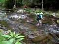
And a couple of videos about fording Slickrock Creek:
So if you are thinking about hiking the BMT, HERE is where you go to get the guide you need. |
|---|